Deprivation (IMD)
Deprivation is in a broad way to encompass a wide range of aspects of an individual’s living conditions. IMD is based on seven different domains, which in turn are created from several different data sets.
- Income Deprivation
- Employment Deprivation
- Education, Skills and Training Deprivation
- Health Deprivation and Disability
- Crime
- Barriers to Housing and Services
- Living Environment Deprivation
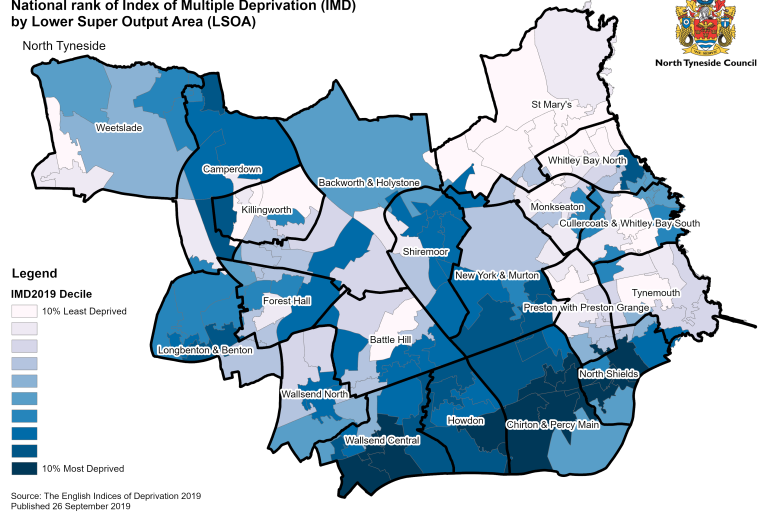
Every neighbourhood in England is ranked, and then ordered into 10 groups, to rank the most to the least deprived. The map below highlights the IMD ranks across the borough.
Image

The more deprived areas in both England and Wales experienced a higher number of deaths from leading causes such as heart diseases, chronic respiratory diseases and lung cancer than less deprived areas.
